


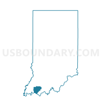
BOON 03, Warrick County, Indiana
About
Outline

Summary
| Unique Area Identifier | 581107 |
| Name | BOON 03 |
| County | Warrick County |
| State | Indiana |
| Area (square miles) | 0.56 |
| Land Area (square miles) | 0.56 |
| Water Area (square miles) | 0.00 |
| % of Land Area | 100.00 |
| % of Water Area | 0.00 |
| Latitude of the Internal Point | 38.03692670 |
| Longtitude of the Internal Point | -87.27868780 |
Maps


Graphs
Select a template below for downloading or customizing gragh for BOON 03, Warrick County, Indiana


Neighbors
Neighoring Voting District (by Name) Neighboring Voting District on the Map
- BOON 01, Warrick County, IN
- BOON 02, Warrick County, IN
- BOON 04, Warrick County, IN
- BOON 10, Warrick County, IN
- BOON 13, Warrick County, IN
- BOON 15, Warrick County, IN